


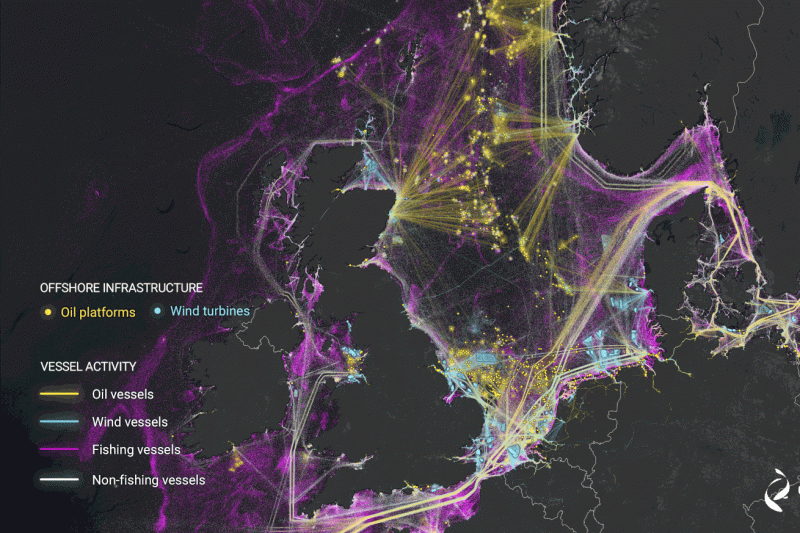
A new study uses deep learning and satellite imagery to create the first global map of vessel traffic and offshore infrastructure. | Image: Global Fishing Watch
Using satellite imagery and AI, researchers have mapped human activity at sea with more precision than ever before. The effort exposed a huge amount of industrial activity that previously flew under the radar, from suspicious fishing operations to an explosion of offshore energy development.
The maps were published today in the journal Nature. The research led by Google-backed nonprofit Global Fishing Watch revealed that a whopping three-quarters of the world’s industrial fishing vessels are not publicly tracked. Up to 30 percent of transport and energy vessels also escape public tracking.
Those blind spots could hamper global conservation efforts, the researchers say. To better protect the world’s oceans and fisheries, policymakers…